
Knocknabrone Hill [Derryfanga] [Cnoc na Bron]
Good walks are even better shared.
Overview
Knocknabrone Hill Overview
Nestled in the scenic countryside of Northern Ireland, Knocknabrone Hill, also known as Derryfanga or Cnoc na Bron, offers a fulfilling hike for those seeking tranquility away from the bustling city life. With an elevation of 479 meters and a prominence of 123 meters, it stands proudly among the hills.
Geology
The hill is primarily composed of sedimentary rocks with volcanic features, showcasing geological layers that tell the Earth's story. The surrounding landscape is a mix of lush-green fields and rugged terrain, perfect for adventurers keen on exploring diverse environments. Be ready for some bogginess underfoot in places, which adds to the character!
Routes
The Derryfanga Approach is the most popular route, stretching roughly 5 km and taking around 2 hours to complete. This moderate hike winds through picturesque landscapes, offering glimpses of local wildlife and the region's natural beauty.
Summit Features
At the summit, you will find a simple cairn and a trig point, an ideal spot to take a moment for a photo-op or to relish your accomplishment. On a nice day, it's possible to bask in the views while contemplating the meaning of life—or wondering where the nearest café is!
Terrain Type
The terrain is a mix of grassy slopes and occasional rocky outcrops. Be aware that some areas can be quite boggy. Good footwear is a must, or you might end up with soggy socks that will spoil the best part of your hike.
Views
Once at the summit, you’ll be treated to breathtaking views of Glenelly Valley and the rolling peaks of the Sperrin Mountains. The best times for viewing are during spring and early autumn, when the skies are typically clear and the landscape bursts with colour.
Hazards
As with many hills in the region, sudden weather changes can occur, swirling in faster than a pot of water boiling. Ensure to check the forecast before heading out, and be prepared for the twists and turns of Mother Nature.
Nearby Summits
For those looking to extend their adventure, nearby summits include Glenelly Mountain (629 m) and Brockagh Mountain (554 m), both of which can be combined into a longer hike for the seasoned explorer.
Access
Parking is available in Derryfanga, just a stone's throw from the trailhead. If you're using public transport, a limited bus service from Omagh can get you to the village. The closest town, Omagh, is well-equipped with amenities including cozy cafés—perfect for a post-hike recovery.
Facilities
In Omagh, you’ll find various facilities, including eateries and public toilets to freshen up after your outdoor exploits.
History
The name Cnoc na Bron carries the connotation of deep-rooted historical significance, potentially linking to tales of ancient chieftains and sorrowful legacies of the area. It’s a reminder that while the hill may be serene now, it has seen its share of human drama!
Knocknabrone Hill is a gem in the Irish landscape, perfect for anyone looking to escape the noise and embrace nature’s quiet beauty. Happy hiking!
Explore routes near Knocknabrone Hill [Derryfanga] [Cnoc na Bron]
Public walks starting within 80 km of this hill. Nearby does not mean a route reaches the summit; check its map and access before setting out.
No public routes are currently listed within 80 km of Knocknabrone Hill [Derryfanga] [Cnoc na Bron] on Walkmates. This does not mean there are no paths here. Explore the map and check local access information before planning a walk.
Route planning notes
These notes describe possible approaches, not verified navigable routes or permission to cross land. Check current paths, local access rules and conditions before setting out.
Derryfanga Approach
A scenic route starting from the village of Derryfanga, meandering through lush landscapes and gentle inclines.
Make a day of it, together
Find someone to share the walk with, or organise a day out along a route you like.
Hill facts and local notes
Classifications
Elevation
353m
1,158 ft
Prominence
190m
Coordinates
52.0198, -9.8114
V757868
OS Map
78
At the Summit
The summit features a small cairn and a delightful trig point, perfect for that 'I made it' selfie.
Terrain & Geology
Consists mainly of sedimentary rocks, with some volcanic outcrops, typical of the surrounding Mourne Mountains area. The soil can be boggy, contributing to the rich biodiversity in the region.
Views & Scenery
From the summit, you can see the sweeping landscape of Glenelly Valley and, on a clear day, the distant peaks of the Sperrin Mountains.
History & Heritage
Name Origin
Cnoc na Bron translates to 'Hill of the Sadness', potentially referencing historical events or folklore associated with the area.
Historical Significance
The hill is significant in local folklore, often linked to ancient legends that tell of local chieftains and battles fought in the shadows of its slopes.
Getting There & Facilities
Check current local access restrictions, parking rules and transport timetables before travelling. These notes do not confirm public access to the summit.
Parking
There is ample parking available in Derryfanga, just a short walk from the trailhead.
Public Transport
Limited bus services operate from Omagh to Derryfanga; check local timetables for details.
Nearby Facilities
The nearest town, Omagh, offers various facilities including cafés, shops, and public toilets.
Safety Information
Known Hazards
- Watch out for unmarked terrain and sudden weather changes, which can sneak up on you like your Auntie at a family gathering.
General Safety Tips
- Check weather conditions before setting out
- Carry appropriate clothing and equipment
- Let someone know your planned route
- Take a map, compass, and GPS device
- Carry emergency supplies: food, water, first aid kit, torch
Hills
Some common questions about the hills answered
Are there group walks up Knocknabrone Hill [Derryfanga] [Cnoc na Bron]?
Many walkers use Walkmates to join or organise walks with others. You can check for group walks around Knocknabrone Hill [Derryfanga] [Cnoc na Bron] through the maps
Are there other walkers around Knocknabrone Hill [Derryfanga] [Cnoc na Bron]?
Activity varies by location and time, but Walkmates lets you see whether others have shared walks or shown interest in this area. Find other people through the walking friends search walking friends for Knocknabrone Hill [Derryfanga] [Cnoc na Bron] search or of course create your own walk for Knocknabrone Hill [Derryfanga] [Cnoc na Bron]
Can I organise a walk to Knocknabrone Hill [Derryfanga] [Cnoc na Bron]?
Yes. If there aren’t any walks listed already, you can create a walk and make it available for others to join.
If you're signed up to Walkmates, you can create a walk to Knocknabrone Hill [Derryfanga] [Cnoc na Bron].
How do I find a walk up this hill?
There are often multiple ways to walk this hill, depending on experience and route preference. Walkmates helps you explore walks and routes that others have shared.
Can I suggest a new route up Knocknabrone Hill [Derryfanga] [Cnoc na Bron]?
Yes. You can suggest or create routes to share with others. Walkmates focuses on the social side of walking, so routes are used to help people organise walks and explore areas together, rather than as detailed navigation tools or route libraries.
Other uses really appreciate knowledgeable walkers sharing their routes. Share your favourite route to Knocknabrone Hill [Derryfanga] [Cnoc na Bron] here
The is an error or something incorrect about this hill. How do I let you know?
We always strive to keep the information on Walkmates as accurate as possible. If you find an error, please let us know through the contact form and we'll aim to correct it as quickly as possible
Community Discussion
Comments
Location
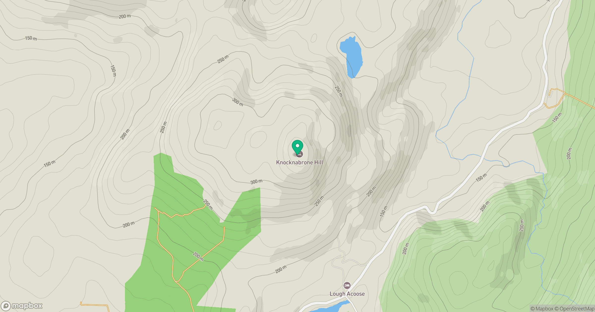
Grid reference: V757868
View on OpenStreetMapOpens a map in a new tab, centred on the hill.
Hills within 30 km
Straight-line distance, not a walking route or confirmation of access.
No comments yet. Be the first.